

 Image 1 of 5
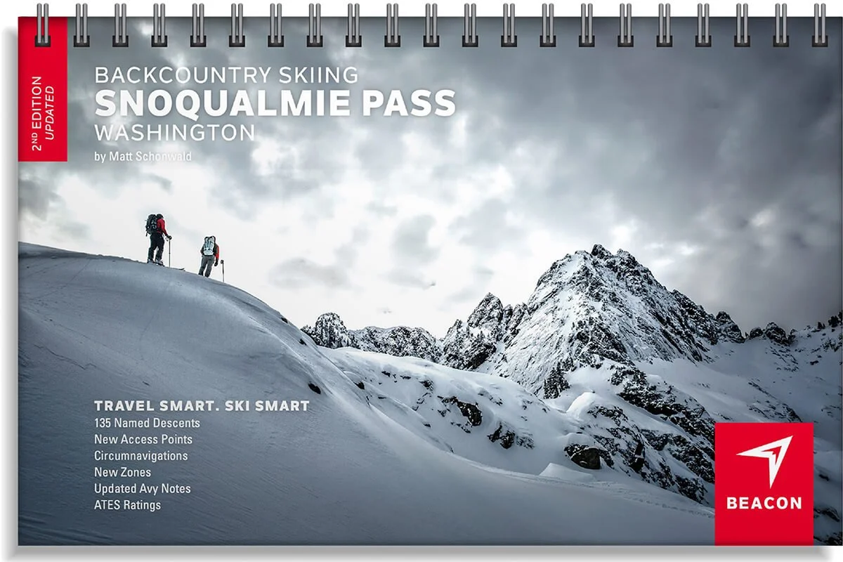 Image 2 of 5
 Image 3 of 5
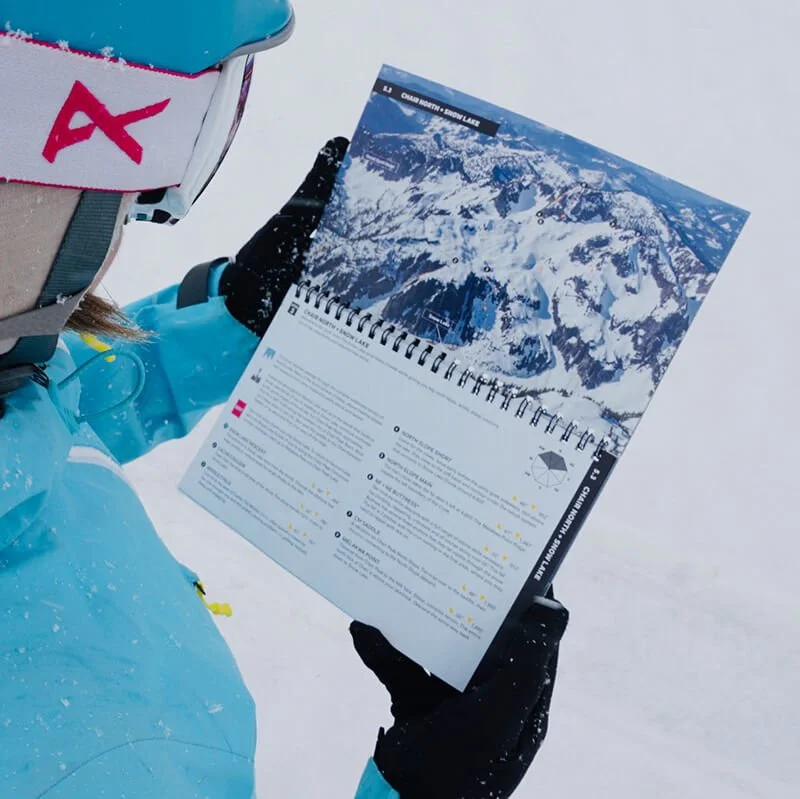 Image 4 of 5
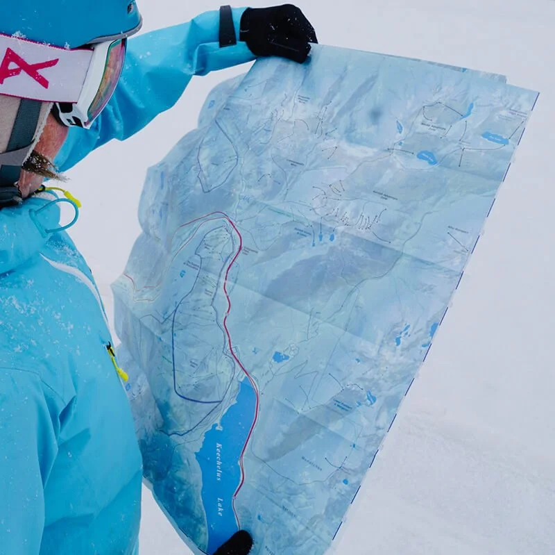 Image 5 of 5
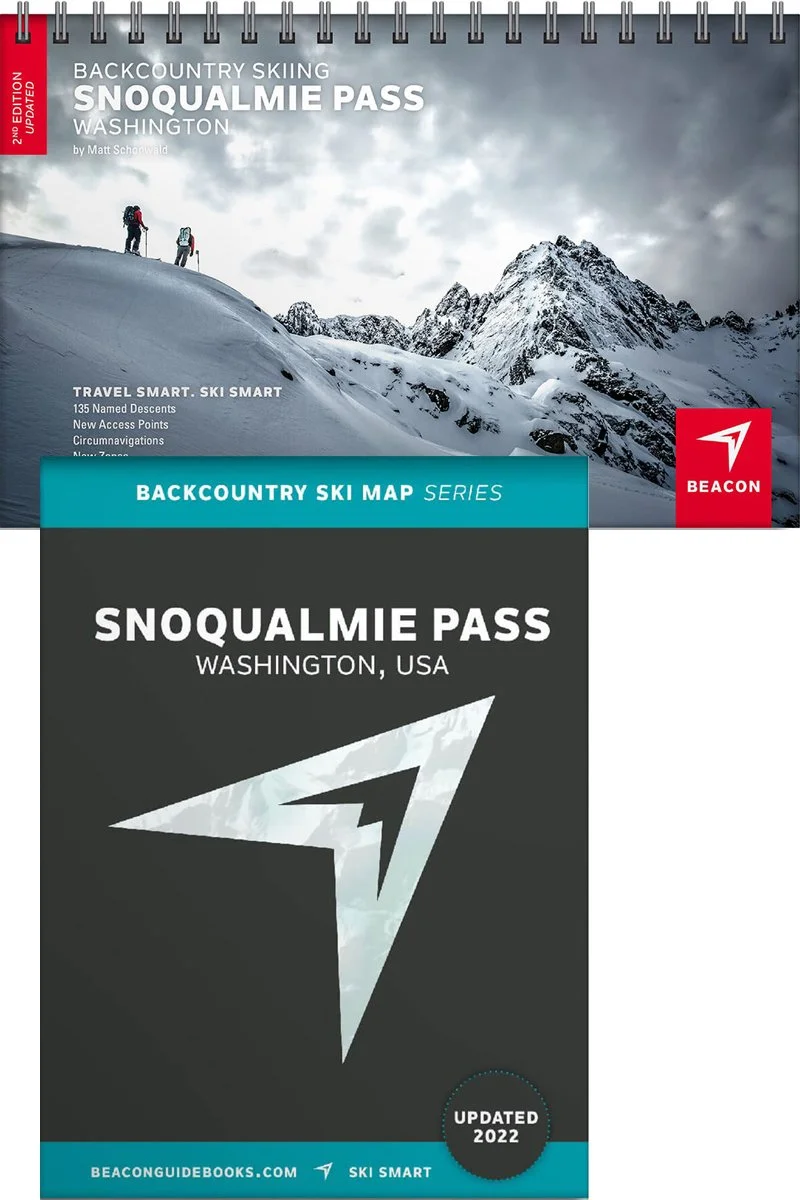
Backcountry Skiing Snoqualmie Pass, Washington


Snoqualmie Pass Backcountry Skiing Book and Map
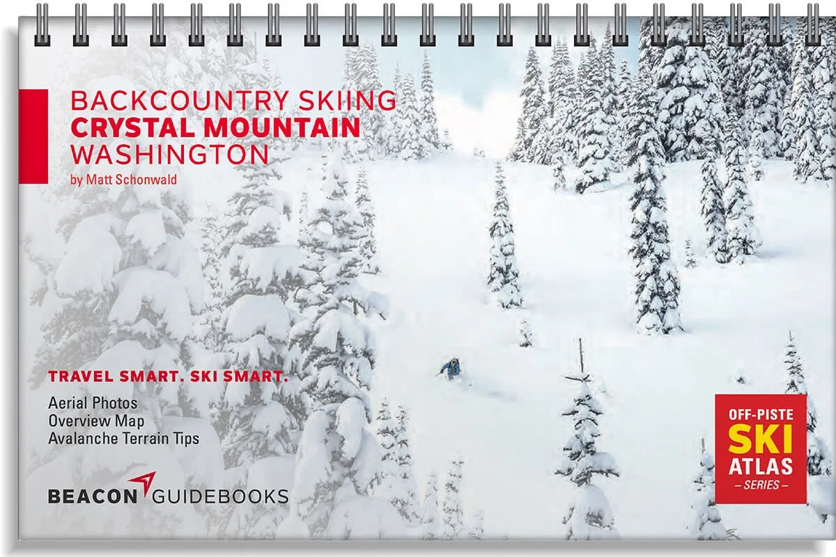
Welcome to Snoqualmie Pass, the classic and most popular backcountry skiing and splitboarding spot in the Cascades within an hour of downtown Seattle. From legendary couloirs and steep faces to mellow glades and desirable slopes, the diversity of runs in this guidebook give adventurers of every level something to do. The second edition includes approaches, exits and circumnavigations as well as more coverage of Denny Creek, Alaska Adventure Zone, and the high routes. Matt Schonwald, professional ski guide and author, addresses each zone’s terrain as it relates to avalanche hazards. You’ll see references to slope angles, terrain traps, convexities, and other hazards to keep in mind on each given zone.
Every single page and detail are highly curated and reviewed to provide a professional and reliable decision making tool. Designed to go along with you on your tours and accompany the Backcountry Skiing Snoqualmie Pass Ski Map.
The book and map cover the following zones: Humpback Creek, Silver Peak, Granite Mountain South, Granite North + Low, Denny Creek to Melakwa Pass, Source Lake South, Chair East + Snow Lake Divide, Chair North + Snow Lake, Wright + Roosevelt, Chair Peak Circumnav, Snoqualmie Mountain, Phantom, Commonwealth West & East, Kendall Stump +Lakes, Kendall Adventure (West, Central & East), Alaska Adventure Zone, Mini Snoqualmie High Route, Lower Rampart + Margaret, Cold Creek Overview, Roaring Ridge, Twin Lakes + Zipper Couloir, and Mount Catherine.
Book Features
5.5” x 8.5” spiral-bound book
71 color pages
135 descents and the Snoqualmie’s most classic lines
High-quality aerial photos with ascent and descent indicators
Highly-curated, professionally-reviewed zone and run descriptions
Access and approach information with terrain and avalanche exposure tips
Slope angles, aspect, descent lengths
Avalanche Terrain Exposure Scale (ATES) ratings
Parking and trailhead information
Simple and easy-to-read format
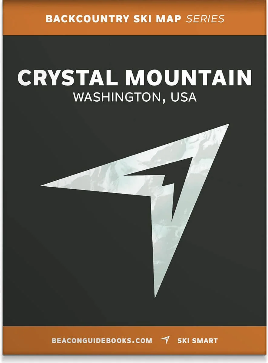
Map Features
Waterproof
Tearproof
18” x 36” open
4” x 5.5” folded
1.5 ounces
1:24,000 scale
Parking and trailhead information
Resort boundaries
Ski descents and uptracks detailed
Slope angles
Avalanche Terrain Exposure Scale ratings