

 Image 1 of 5
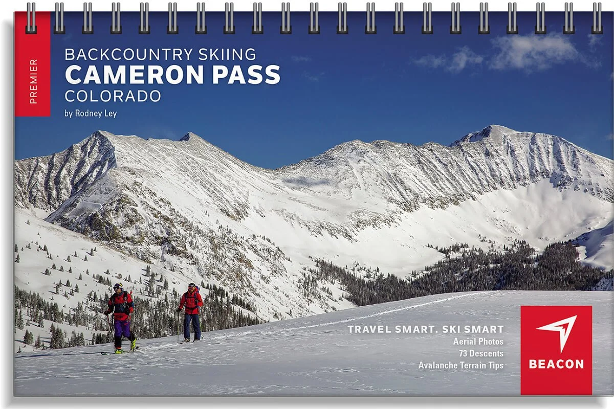 Image 2 of 5
 Image 3 of 5
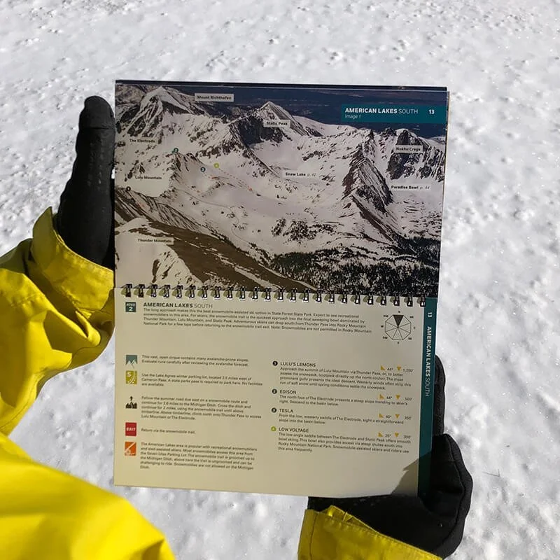 Image 4 of 5
 Image 5 of 5
Backcountry Skiing Cameron Pass, Colorado

Cameron Pass Backcountry Skiing Book and Map
Local author and explorer Rodney Ley, has put his breadth of knowledge and 50 years of experience on Cameron Pass into this meticulously curated guidebook.
Just 65 miles west of Fort Collins, quiet and undeveloped “Cam Pass” also receives a generous amount of snow each winter and stellar skiing often extends late into the spring. With relatively easy highway access, this area has become a favorite spot for day tours and overnight yurt trips from both sides of the range. The Cameron Pass zone boasts big lines, mellow day tours and everything in between.
The book and map cover the following zones: Kelly Ridge, Ruby Jewel Cirque, Clark Peak, Sawmill Creek, Montgomery Pass North, Montgomery Bowls, North Diamond Peak, South Diamond Peak, Zimmerman Lake, Hot Dog Bowls, Enchanted Forest, Iron Mountain West, American Lakes South, Snow Lake Ridge, Paradise Bowl, Nokhu Crags North, Lake Agnes Bowl, Braddock Peak East, Braddock Peak West, Seven Utes Mountain East, Seven Utes Mountain West.
Book Features
5.5” x 8.5” spiral-bound book
59 color pages
75 routes accessible to a wide range of skiers and riders
High-quality aerial photos with ascent and descent indicators
Highly-curated, professionally-reviewed zone and run descriptions
Access and approach information with terrain and avalanche exposure tips
Slope angles, aspect, descent lengths
Avalanche Terrain Exposure Scale (ATES) ratings
Parking and trailhead information
Simple and easy-to-read format
Spiral-bound; lightweight and portable size
Map Features
Waterproof
Tearproof
75 routes
18” x 22” open
4” x 5.5” folded
1:32,000 scale
Parking and trailhead information
Ski descents and uptracks detailed
Slope angles
Avalanche Terrain Exposure Scale ratings